
 English
 Română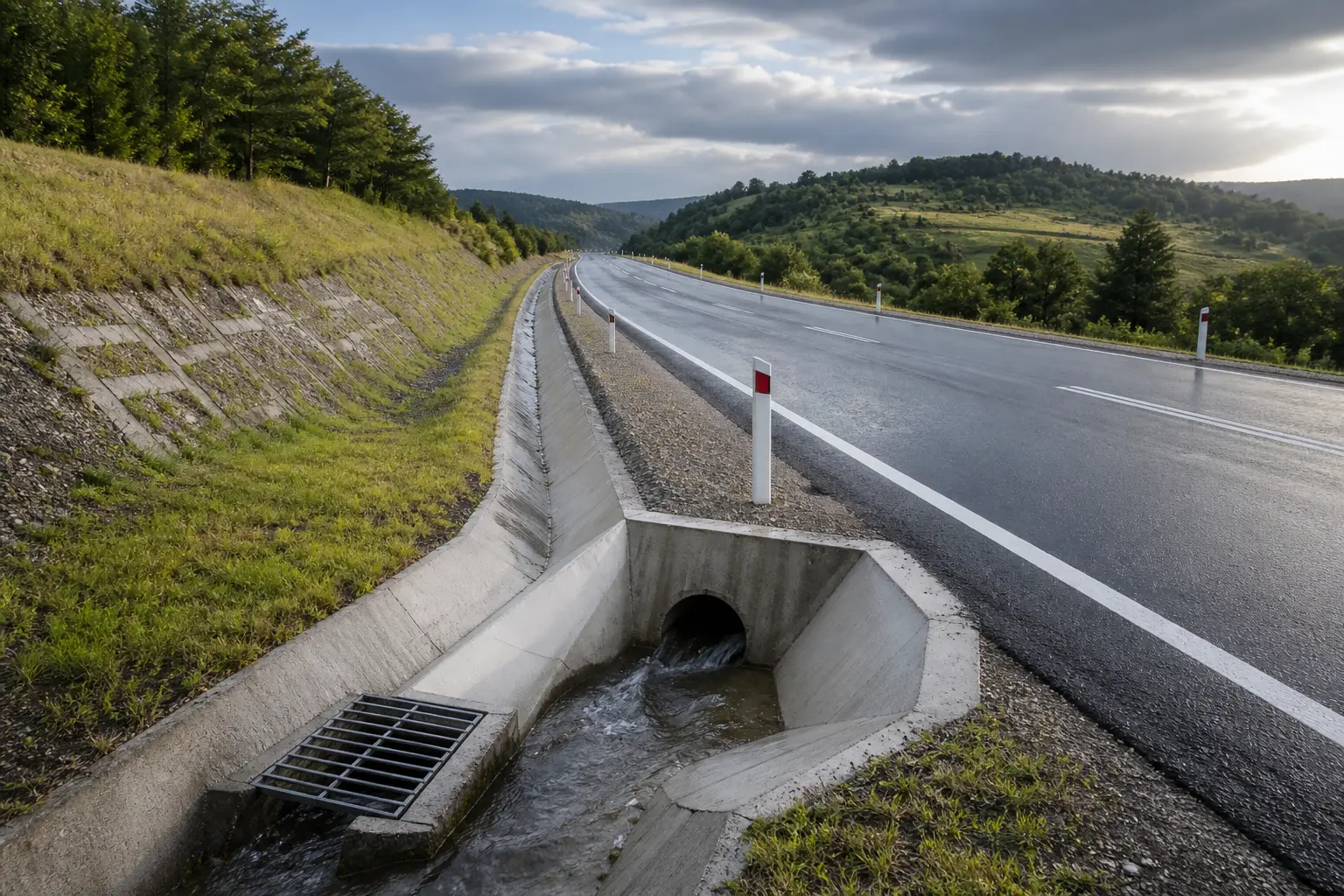
Water usually finds the weakness in a road before traffic does.
A surface may look properly finished on opening day, yet a low point that holds rain, an outlet with insufficient fall or water trapped beneath the pavement can begin causing trouble much later. By the time cracks, settlement or damaged shoulders become visible, the original drainage decision may be difficult and expensive to correct.
This is why drainage cannot sit at the end of the road design process as a collection of pipes and gullies. It starts with the route, the levels and the way the road changes the movement of water across the land.
For a project owner, the useful question is not simply, “Where will the drains go?” It is, “Can water travel through the entire system—from the point where rain falls to a safe and workable discharge—without creating another problem on the road or beyond it?”
Drainage begins before the first pipe is drawn
It is easy to think of drainage as a separate technical layer. The road alignment is decided, the profile is fixed and the drainage engineer is then asked to fit inlets, ditches and pipes around it. On uncomplicated sites that approach may appear to work. On constrained land, it can leave very little room for a sensible solution.
The longitudinal gradient controls where surface water wants to travel. Crossfall directs it across the carriageway. Kerbs, medians, junctions, bridge approaches and access points interrupt that path. Every sag curve creates a place that deserves attention, particularly when water has no natural escape route.
So the road profile is already part of the drainage system. A small adjustment to a level early in design may remove the need for a deep pipe, reduce excavation or avoid a pumping solution. The same adjustment becomes much harder once tie-ins, property access, utilities and structural clearances have all been fixed.
Good road design services therefore develop geometry and drainage together. The objective is not to make one discipline win over another. It is to find a coordinated solution that can be built, maintained and operated safely.
Surface water, groundwater and the outlet form one system
A road has more than one water problem.
Rain falls on the carriageway and needs to leave the trafficked surface quickly. Runoff also arrives from slopes, neighbouring land and side roads. Below the surface, groundwater or water entering through pavement joints can affect the foundation layers. At the far end of the system, everything that has been collected still needs somewhere appropriate to go.
Treating these as unrelated tasks can produce a design that works only on paper. A pipe may have enough capacity but no practical outlet. A ditch may carry the expected flow but erode at its discharge point. An inlet may be correctly sized yet sit a few centimetres above the true low point once the road is built.
A coordinated review follows the water through the complete route:
- Where does the water come from, and how much land contributes to the flow?
- How does it reach the road, channel, inlet or culvert?
- Can each element convey the design flow without creating an unsafe spread or uncontrolled erosion?
- Where is the water discharged, and what happens downstream?
- Can the system be reached, inspected and cleaned after construction?
The exact calculations and design criteria are project-specific. Road category, terrain, rainfall inputs, receiving waters and authority requirements all matter. As a useful technical reference, the United States Federal Highway Administration’s Urban Drainage Design Manual (HEC-22) follows the same whole-system logic: rainfall and runoff, pavement drainage, gutter flow, inlets, ditches, structures and storm-drain piping are treated as connected parts of transport drainage.
A dry-looking site can still hide a difficult drainage problem
A site visit in good weather tells only part of the story. The ground may be dry because the visit follows several rainless days. A shallow depression may look harmless until runoff from a wider catchment reaches it. An existing culvert may be visible, but its internal condition or downstream route may not be clear.
This is where reliable survey information becomes important. Topography shows more than the road centreline; it needs to capture the land that controls incoming and outgoing flows. Utility information can determine whether a gravity pipe has a viable corridor. Geotechnical findings help the team understand whether water beneath the pavement or within earthworks needs additional control.
Existing infrastructure also needs to be verified rather than assumed. An old drawing does not prove that a pipe remains open, lies at the recorded depth or has permission to receive additional flow. When the outlet is fundamental to the project, uncertainty around it should be resolved before the detailed design becomes dependent on it.
What happens when drainage decisions are left too late
Late drainage changes rarely stay within the drainage drawings.
Suppose the proposed outlet turns out to be higher than expected. The pipe cannot achieve the required fall. Lowering it may conflict with a utility or require deeper excavations. Raising the road might affect entrances, earthworks and land boundaries. Moving the outlet could introduce a new approval process. What began as one incorrect level now touches several parts of the project.
A similar chain reaction occurs at structures. Culvert openings, bridge-deck drainage, approach levels and protection against erosion need coordination between road, drainage and structural engineers. Bringing the bridge design team into those discussions early is far more efficient than asking it to accommodate a finished road profile later.
The lesson is not that every detail must be known at feasibility stage. That would be unrealistic. The important point is to identify the decisions that could change the viability or cost of the scheme, investigate them at the right level and record the assumptions that remain.
Different roads create different water problems
There is no universal drainage layout that can simply be repeated from one project to another.
An urban street
Space is often the main constraint. Kerbs, footways, property entrances, buried utilities and frequent junctions compete for the same narrow corridor. Surface-water spread affects pedestrians as well as vehicles, while maintenance teams need safe access to inlets and chambers.
A road on an embankment
The issue may be less about collecting water and more about controlling its energy. Unprotected discharge down a slope can cause erosion, damage the shoulder and threaten the stability of the earthworks. The route from the carriageway to the toe of the embankment needs to be deliberate.
A cutting or mountain route
Water can arrive from above and below the road. Intercepting flows before they reach the cutting, controlling seepage and keeping channels clear may be as important as the pavement drainage itself. Access for inspection cannot be an afterthought in terrain that is already difficult to reach.
An industrial access road
Large paved areas can generate rapid runoff, while heavy vehicles place high demands on pavement edges, channels and covers. The drainage layout has to coexist with loading areas, turning movements and the day-to-day operation of the site.
These examples share the same principle: the design should respond to how the particular site behaves, not just to the label attached to the road.
Road drainage also has a safety role
Standing water is not only a durability issue. On the trafficked surface it can reduce visibility through spray, affect braking and increase the risk of loss of control. At a pedestrian crossing or footway, poor drainage can leave users stepping into water or moving outside the intended route.
Geometry, inlet spacing and maintenance condition all influence how quickly water clears. A calculation alone cannot show whether the arrangement will be obvious and workable on the finished road. The design needs a practical review of low points, lane changes, junctions, crossings, bridge transitions and areas where debris is likely to collect.
For infrastructure expected to remain in service for decades, future conditions also deserve consideration. The European Commission’s technical guidance on climate-proofing infrastructure provides an official framework for screening and assessing climate risks for relevant investments. How that guidance and Romanian requirements apply must be established for the individual project, its funding and approval route.
A good drainage design can still fail during construction
Drainage is sensitive to small construction differences. An inlet set too high, a pipe laid with an unintended dip or a channel obstructed by concrete can change how the entire local system behaves. Temporary works also matter: bare slopes and unfinished earthworks can release sediment into pipes before the road opens.
Several checks are especially valuable on site:
- confirming levels and falls before elements are covered;
- checking that inlets coincide with the constructed low points;
- verifying pipe connections, headwalls and erosion protection;
- keeping channels and drainage structures clear during the works;
- recording changes so that the final information reflects what was actually built.
Professional construction site supervision helps connect the approved design with what is executed. It cannot replace the contractor’s responsibilities, but it can identify deviations while they are still visible and practical to correct.
Maintenance has to be designed in
Every drainage system will collect something besides water. Leaves, sediment, litter and material from unprotected slopes eventually reach inlets, ditches and chambers. If those elements cannot be reached safely, opened with normal equipment or inspected without disrupting the whole road, routine maintenance becomes unlikely.
This is a design issue, not just an operational one. A theoretically efficient inlet in an inaccessible location may perform worse over time than a slightly different arrangement that crews can actually maintain. The same is true for deep chambers, long enclosed runs and outlets hidden by vegetation or steep ground.
Before approving the layout, it is worth imagining the system five years after opening. Where will sediment settle? Which component will block first? How will a crew get to it? What happens to traffic while it is cleaned? Those questions often reveal details that a hydraulic model does not.
What a client should ask before approving the design
A client does not need to repeat the engineer’s calculations. The most useful review is about the logic of the solution and whether the main risks have been made visible.
- Has the contributing catchment been defined, including water arriving from outside the road boundary?
- Are the critical low points and overland flow routes shown clearly?
- Is the proposed discharge point verified and acceptable to the relevant parties?
- Have road levels, utilities, structures and property constraints been coordinated?
- What happens if an inlet blocks or the design event is exceeded?
- Can every important component be inspected and maintained safely?
- Which assumptions still need confirmation before construction?
Clear answers do not guarantee that a project will never face unexpected conditions. They do show that the design team understands the whole route taken by the water and has not reduced drainage to a schedule of components.
Frequently asked questions
At what stage should road drainage be considered?
From the first route and level studies. Detailed pipe and inlet design may come later, but the catchments, low points, possible outlets and major constraints should influence the concept from the beginning.
Is surface drainage enough to protect a pavement?
Not always. The need for subsurface drainage depends on the pavement build-up, ground conditions, groundwater and how water may enter or move through the layers. It should be assessed for the specific project.
Can an existing drainage system receive water from a new road?
It should not be assumed. Its location, level, condition, capacity and the right or approval to connect all need to be confirmed. Downstream effects may also require assessment.
Who coordinates drainage at a bridge or large culvert?
The responsibilities should be stated in the project brief, but close coordination is needed between road, drainage, geotechnical and structural engineers. Levels, openings, scour or erosion protection, foundations and construction sequence can affect more than one discipline.

